For a long time, Killeshandra has been known as 'a flourishing and respectable little place.' Today, Killeshandra hasn’t changed very much. Still a rural village, it's set in the middle of unspoilt countryside, green fields, forests, and dozens of lakes and rivers, offering you a relaxed break from the frantic rush of everyday city life.
There’s a wide range of things to do and see in the area, including angling, golf, horse riding, swimming, boating, and walking. The town is situated among some of the best fishing rivers and lakes in the country. Bream, roach, pike, eel, and tench are plentiful. Trout fishing is also available in a number of lakes.
The town lake, on the outskirts of the town (and from where this looped walk begins), is an ideal venue for all sorts of watersports and is now a venue for a round of the All-Ireland Power Boat Championships, held in conjunction with the local festival on the June Bank Holiday weekend.
Killeshandra is only 5km from the magnificent Killykeen Forest Park, a wonderland of lakes, rivers, and forests renowned for its beauty and solitude. Facilities at Killykeen include excellent fishing, nature trails, and pony trekking. Killeshandra is also a recognised centre of traditional Irish music and dance.
Routes:
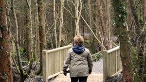
A-B: Starting from the car park at Town Lough, follow the purple arrows onto the surfaced pathway through the wooden railings. Continue to follow the path and along the lakeshore for almost 600m before exiting onto a roadside path. Turn left and follow the path for 200m before crossing the road to enter forestry via wooden barriers.
B-C: After entering the forestry, follow the purple arrows along forestry roads. After 2km in a mix of broadleaf and coniferous woodlands, the loop exits onto a sandy roadway, where it turns right and after 500m joins a minor road at a T-junction - again, turning right.
B-C: After 300m, the loop swings sharply left at a three-way junction, approximately 300m afterwards it leaves the surfaced road, turning right and entering forestry.
D-A: The forestry section takes you onto the edge of Pleasure Lake. Climbing to reach a car park on the side of the R199, the loop descends into the town of Killashandra. After strolling through the main street, the loop turns sharply right at the Ulster Bank and makes it’s way back to the trailhead.
Trail details
- Type:
- Walking Trail
- Location:
- Killeshandra
- Grade:
- Easy
- Format:
- Loop
- Length:
- 5.90km
- Ascent:
- 60m
- Dogs allowed:
- Yes
Don't leave Killeshandra before you visit the Jacobean Church built in 1688, now a substantial ruin well worth seeing.
