View MapView Map
Paradise Hill Loop
Kilfinane, Co. Limerick
Family friendly
Free to visit
Paid car parking
Paradise Hill Loop is located in the middle of Ballyhoura country – starting and finishing in the small village of Anglesboro at the foot of the Galtee Mountains, in the south-east of County Limerick.

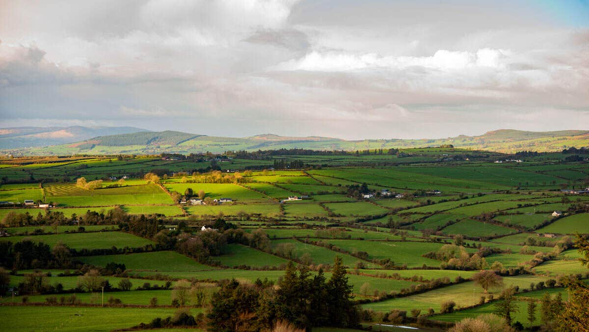
Situated in the southwest region of Ireland, on the borders of counties Tipperary, Limerick and Cork, Ballyhoura Country is an area of undulating green pastures, woodlands, hills and mountains. The ancient and unspoilt landscape, the abundance of heritage sites, the range of outdoor activities, and the friendliness of the local people make it an excellent place to discover rural Ireland. This loop is located in the middle of Ballyhoura country – starting and finishing in the small village of Anglesboro at the foot of the Galtee Mountains, in the south-east of County Limerick. The area is given mostly to agriculture, dairy farming being the main preoccupation.

Directions to Trailhead

A-B. Starting from the Community Centre, follow the green (and purple) arrows downhill and veer right at the road junction. The purple arrows are for the longer Benard Loop. Pass Lane’s Shop on your right and continue out of the village and uphill to join a laneway on your right. Turn right here.

B-C. Follow the green and purple arrows along the laneway and into forestry across Paradise Hill.

On the descent watch for a stile on your right as both loops turn into forestry. After 50m the loop turns right and follow the forestry road for almost 2km to reach a 3-way junction where the Benard Loop turns right - but you continue straight. After 200m you reach a 3-way junction where you rejoin the Benard Loop and turn left.

C-D. Now follow both loops for 200m to reach a T-junction where you turn right, and after 300m take a sharp left. Now follows a long ascent to the highest point of the loop on the shoulder of Temple Hill. Fine views open up on your left as you descend to reach a sharp left turn where the loop turns right and crosses a stile into a field and turns left and downhill.

D-A. The loop descends for 200m to reach the stile you crossed at B above. This time continue straight and rejoin the outward section of the loop on the return to the trailhead.

Trail details

Type:
Walking Trail
Location:
Ballyhoura Anglesborough Loops
Grade:
Strenuous
Format:
Loop
Length:
7.20km
Ascent:
90m
Dogs allowed:
No
    Time:3 hours
    Nearest town start:Anglesboro/Michelstown
    Nearest town finish:Anglesboro/Michelstown
    Start point:Anglesborough
    Finish point:Anglesborough
    Waymarking:Green arrow on white background
Tips from locals

This is a long loop of 13km. Bring walking sticks as some of the paths are quite steep. Worth the climb for great views including the Seefin Mountain.
Contact details
Community Centre,Anglesboro,Co Limerick,Republic of Ireland
Leave no trace
  • Plan ahead and prepare
  • Be considerate of others
  • Respect farm animals and wildlife
  • Travel and camp responsibly
  • Leave what you find
  • Dispose of waste properly
  • Protect nature from fire
Mail Icon SVG

Subscribe now to receive destination inspiration, travel tips, upcoming events and all the best things to do around Ireland.