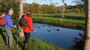
The section of the river downstream from O'Briensbridge is noted for angling and watersports. Upstream at Parteen the flow of the Shannon is diverted into a man-made canal (called the Shannon Headrace) for a hydroelectric station at Ardnacrusha. The Errinagh Canal was built to allow navigation of boats and barges to the city of Limerick . Today, the canal is being developed as a recreational amenity (fishing, watersports, etc) – the loop uses what was the towpath for horses as they pulled barges in previous times. This loop uses the riverbank and towpaths from O’Briensbridge to Clonlara and returns via the headrace embankment.
A-B. Starting from the riverside car park, follow the pathway along the River Shannon away from the village. You are following the red arrows on the waymarkers but there are also blue arrows (for the shorter Errinagh Bridge Loop which you will leave) and the yellow arrows of the Lough Derg Way (a long-distance walking route which goes from Limerick City to Killaloe). The pathway soon enters an area of natural woodland along the bank of the river – this was the old towpath. After 1km the route swings right as you join the Errinagh Canal.
B-C. Continue to follow the canalbank to reach Errinagh Bridge. Go under the bridge, and on your exit, climb the embankment and turn left following the red and yellow arrows. (Notice that the blue loop turns right at this point as it makes its way back to O’Briensbridge.)
C-D. Follow the red and yellow arrows along a mix of towpath and sandy roadways, passing a canal lock on the way. At the end of this section you join a tarred road where you turn right and, after 200m enter Clonlara Village. In the village, turn right onto a roadway.
D-E. Follow the roadway onto the embankment of the Shannon Headrace and follow it for 5km (picking up the blue loop on the way) to exit via a stile at the end of forestry and onto a roadway. Continue straight here.
E-F. After 300m enter the village again, turning right as you join the tarred road.
F-A. Follow the road through the village – enjoying the 200m back to the trailhead.
Trail details
- Type:
- Walking Trail
- Location:
- O'Briensbridge Loop Walks
- Grade:
- Moderate
- Format:
- Loop
- Length:
- 11.60km
- Ascent:
- 10m
- Dogs allowed:
- Yes
