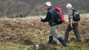
This loop starts and finishes in the village of Galbally – at the heart of Ballyhoura Country. The loop takes you to the pinnacle of a 265m high hill north-west of the village where there is a megalithic passage grave known as The Fort of the Three Pillar Stones. The fort is perhaps 6,000 years old and is known locally as ‘Darby’s Bed’.
The tomb has a long almost inaccessible entrance passage, and the roof rises likes steps to the top of its chamber and is regarded as being similar to megalithic tombs in Brittany, France. The entrance passage faces north-west in line with the mid-summer sunset. According to fable and folklore it is believed that it is the grave of Olill Olum, who was one of the early kings of Munster. Also on the loop is a circular mound, 19m in diameter, and faced with drystone kerbs. It is one of many mounds which can be found in the nearby woodland, all dating back some 4,000 years to the Bronze Age.
Refer to other loops listed on the website for further information on the Ballyhoura area
A-B. Starting from the trailhead in Galbally follow the purple arrow along the path out of the village towards Tipperary (R662). After 300m the loop turns left onto a track and ascends to reach a forestry roadway which takes you through the townland of Snugborough. Approx 2km into the loop you reach a 3-way junction - you will be returning to this point on the inward journey. For now - turn right.
B-C. Continue to follow the purple arrows along the forestry road as it ascends for almost 1km before swinging left atop Deerpark Hill. After 500m of gentle descent, watch for a ‘crossroads’ where you turn left and uphill on a green track.
C-D. Follow this track uphill for 200m to reach a point where the loop turns right - but a white arrow directs you straight ahead to a megalithic tomb. [The tomb is only 150m away and well worth a visit - remember to return to this point to continue the loop]. After another 100m you reach the ruins of a cairn on the highest point of the loop. Fine views of the Ballyhoura and Galtee Mountains from here - enjoy them before starting the descent along a green track which takes you back onto the forestry roadway where you turn left.
D-A. The loop starts to descend gently now and after 600m you regain the 3-way junction at B above. This time, turn right and follow the purple (Inward) arrows for 2km back to the village.
Trail details
- Type:
- Walking Trail
- Location:
- Ballyhoura Galbally
- Grade:
- Moderate
- Format:
- Loop
- Length:
- 4.80km
- Ascent:
- 190m
- Dogs allowed:
- No
In Mitchelstown: Car parking, shops, pubs, restaurants, cafés, take-aways, accommodation, etc.
