A-B. Leaving the trailhead at the Heritage Centre, follow the blue (and green and purple) arrows downhill along the surfaced road. The green and purple arrows are for other loops. After 200m pass a crossroads and 500m later reach a 4-way junction where you turn right onto the ‘beach road’. Note that you have now joined the long-distance Beara Way - waymarked with yellow arrows. Follow this road for 600m past the beach and public toilets and join a sandy roadway which takes you across a stile and onto the coastline.
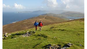
B-C. Follow the blue (green, purple and yellow) arrows as the loop takes you along this superb coastline for 2km.
Joining a surfaced road cross straight over and follow this road for 300m to reach a stile where you turn left. Follow the blue arrows as the loop takes you by farm buildings and uphill to a disused mine area. Joining a surfaced road, turn right and travel downhill for 200m to reach a narrow track on your right. The green loop turns right here - but you continue straight on following the blue (and purple) arrows.
C-D. Follow the roadway for 300m to reach a stile on your left. Cross this stile and follow the blue arrows past old mining buildings to join a minor roadway. After 500m you join a surfaced road and turn left. Follow this road for more than 1km to a junction where you rejoin the Beara Way (yellow arrows). Continue to follow roadway past Kealoge Mine (on your right) to reach a narrow laneway on your right where the purple loop goes straight - but you turn right following the blue (and yellow) arrows.
D-A. The surfaced laneway soon becomes a grassy laneway as it descends. Near the edge of the village you join the surfaced road on which you started out - turn right and enjoy the last 200m back to the trailhead.
Trail details
- Type:
- Walking Trail
- Location:
- Allihies Loops
- Grade:
- Strenuous
- Format:
- Loop
- Length:
- 9.30km
- Ascent:
- 220m
- Dogs allowed:
- No
Take a trip on Ireland's only Cable Car to Dursey Island at the tip of the peninsula.
