The village overlooks Coulagh Bay and the mouth of the Kenmare River and was the location for the shooting of the film The Purple Taxi (1977) starring Fred Astaire, Peter Ustinov, and Charlotte Rampling. More recently, it was also the setting for the 1998 TV series Falling for a Dancer, a dramatisation of life and love in 1930s Ireland based on the novel by Deirdre Purcell. Castletownbere, Ireland’s largest whitefishing port is just 8km away and you can watch the trawlers unload their catch, before sampling the delights in one of the many fine restaurants throughout the peninsula. There are many historical and archaeological sites to visit in the area including a number of standing stones.
A-B. Starting from the trailhead at Sullivans shop in the heart of the village follow the blue arrow onto the access road towards the beach. You are also on the long-distance Beara Way marked with yellow arrows and the familiar trekking man logo. After approximately 1km the loop (and the way) leaves the roadway at a metal gate and accesses Eyeries Point.
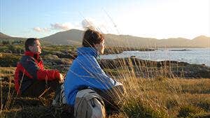
B-C. Follow the sandy roadway to reach the edge of the water and turn right to follow the rugged, rocky shoreline - with high quality scenic views of Coulagh Bay and, in the distance, the coast of Kerry. After 1km you will briefly rejoin a tarred roadway before accessing the shoreline again.
C-D. Now the loop traverses a large number of small farm holdings common to this area before reaching Creha Quay where the longer Coastguard Station Loop (red arrows) and Beara Way (yellow arrows) continue straight onto the coastline again. You turn right here following the blue arrow onto the tarred roadway.
D-E. Continue to follow the tarred roadway for 200m to where the Coastguard Station Loop (red arrows) rejoins it at a laneway on your left. Keep straight ahead here.
E-A. The loop ascends for 500m to enter the cheerfully painted village at its northern end. Turn right and enjoy the remaining 200m through the village and back to the trailhead.
Trail details
- Type:
- Walking Trail
- Location:
- Eyeries Loops
- Grade:
- Easy
- Format:
- Loop
- Length:
- 4.60km
- Ascent:
- 50m
- Dogs allowed:
- No
Take a stroll through the village of Eyeries which must be the most colourful village in the country.
