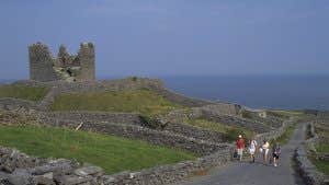
Taking two days to complete and moderate in grade, The Western Way - Galway trail connects the town of Oughterard to the village of Leenaun.
The terrain consists of quiet roads, bog roads, open moorland, forestry tracks, mountain paths and about 3km of timber bog bridge: some parts of the route can be very wet and boggy. About 30km of this 55km route follow local roads.
Showcasing County Galway’s wonderfully rugged landscapes, from Oughterard on Lough Corrib the trail follows the lake’s western edge and heads north into majestic bog and mountain wilderness.
After reaching the village of Maam Bridge, you’ll then cross the Maumturk Mountains before descending into the magnificent Inagh Valley - passing between the Twelve Bens and the Maumturks.
The trail ends on reaching the shores of Killary Harbour and the picturesque village of Leenaun, where you can rest and toast your achievements. Overnight accommodation is limited along this route, so careful planning is necessary.
Trail details
- Type:
- Long Distance Waymarked Way
- Location:
- Oughterard Leenaun
- Grade:
- Moderate
- Format:
- Linear
- Length:
- 59.30km
- Ascent:
- 533m
- Dogs allowed:
- No
- The Western Way follows the western edge of Lough Corrib, one of Ireland’s longest lakes and its second largest.
- Killary Harbour, at the end of this route, is one of only three glacial fjords in Ireland. While the pretty village of Leenaun was one of the filming locations used in the movie The Field.
- There is an additional 3km between Leenaun and the County Mayo border for those walking both the Galway and Mayo sections of The Western Way.
- Connemara National Park, one of Ireland’s six National Parks, is a 20-minute drive from Leenaun.
