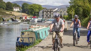
East Kilkenny Cycle Route is a scenic cycling route linking the most historic and culturally significant towns in east Kilkenny. The towns are perfectly placed along the route to stop for lunch or a cup of coffee. The route uses quiet roads and laneways and provides stunning views of Brandon Hill, the River Barrow and the River Nore.
Towns on the East Kilkenny Cycle Route.
The Route start and ends at the Parade, beside Kilkenny Castle, Bennettsbridge, Thomastown, Inistiogue, New Ross, Graiguenamanagh, Gowran and back to Kilkenny city.
Kilkenny on the Road Cycling Route.
Lenght - 65kms
Estimated time 4hr-4.5hrs.
Terrain Rolling country roads and laneways
Traffic: Mainly on quite roads, caution advised at one way system in Thomastown.
Grade Experience moderately fit cyclist.
Minimum Gear: spare tube, pump, liquids, food, mobile phone.
Trail details
- Type:
- Road Cycling Trail
- Location:
- East Kilkenny
- Grade:
- Challenging
- Format:
- Loop
- Length:
- 62.60km
