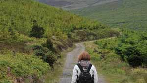
A-B. Starting from the mapboard at the car park, follow the green (and purple) arrow past the barrier. (The purple arrows are for the longer Liam Lynch Loop). Follow the forestry roadway for 600m to reach a 3-way junction where the loops separate - the purple veers left, but you turn right and uphill.
B-C. Continue to follow the forestry roadway as it ascnds and gives you good views into the Knockmealdown Mountains. After nearly 2km the loop descends and takes a sharp right turn. About 200m later you reach metal handrails and steps on your left which lead to a platform to view a waterfall. Take time out to enjoy it.
C-A. From the handrail, continue to follow the forestry roadway for 600m to reach a 3-way junction where the purple loop rejoins from your left. Keep straight ahead here and pass another roadway on your left after 300m. After 1km you reach a T-junction where both loops turn right. Enjoy the 100m back to the trailhead.
This loop takes its name from the townland of Knockballiniry near the village of Goatenbridge (also known as Goat’s Bridge) in County Tipperary. The village is nestled in the valley of the River Suir and on the slopes of the Knockmealdown Mountains. The ‘goats bridge’ spans the River Tar (a tributary of the Suir) which passes through the village. Mountain ranges in the area include the Comeraghs, the Knockmealdowns, Slievenamon and the Galtees – their presence forms a natural amphitheatre of beauty and peaceful existence. Just 4km from Goatenbridge is the village of Ardfinnan which was named after St. Finnan who founded a leper colony just outside the village. See also loop 96B-Liam Lynch Loop
Trail details
- Type:
- Walking Trail
- Location:
- Goatenbridge Loops
- Grade:
- Moderate
- Format:
- Loop
- Length:
- 5.20km
- Ascent:
- 200m
- Dogs allowed:
- Yes
