A-B. Starting from trailhead, follow the purple (and green) arrows out the back of the car park and uphill to join a forestry road at a metal barrier. The green arrows are for the shorter Windfarm Loop. Turn right here and travel 100m to reach a 3-way junction. This is the point from which the loop proper begins - proceed straight on. [Note that you are also following the yellow arrows of the South Leinster Way - a long distance route. You will leave it at the next junction.]
B-C. Follow the forestry road for almost 1km to reach another 3-way junction. Note that the South Leinster Way goes straight here - but you turn left following the green and purple arrows. Continue to follow the forestry road as it ascends through the forestry on the shoulder of Kilbrannish Hill. After 500m you reach a T-junction where the shorter Windfarm Loop turns left - but you turn right and uphill.
C-D. After only 200m, turn left at a 3-way junction. 300m later you reach the brow of a hill which is actually the top of Kilbrannish Hill (400m). The loop continues to climb however and over the next 1km takes you uphill towards Croaghan (455m). Just before the highest point, watch for the purple arrow which directs you left and onto a wide track - this marks the start of the downhill trek back to the trailhead.
D-A. The next 300m takes you downhill quickly to a T-junction where you turn left and continue descending for another 500m to reach a 3-way junction where you rejoin the green loop. Turn sharp right at this junction and after 200m reach the 3-way junction mentioned at A-B above. This time turn right and enjoy the last 100m back to the trailhead.
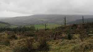
This loop is one of two National Loops in Kilbrannish Woods, (also refer to Trailhead 90a Windfarm loop) which also accommodates part of the long-distance South Leinster Way. The wood predominantly comprises spruce, fir, larch and pine. Vantage points provide magnificent views of the surrounding lowlands, Mount Leinster with its mast tower, and the Blackstairs Mountains. The turbines of a windfarm situated on the summit of nearby Greenoge Hill, are also visible and have an estimated annual output to supply the electrical needs of about 4500 people.
Trail details
- Type:
- Walking Trail
- Location:
- Kilbrannish Loops
- Grade:
- Strenuous
- Format:
- Loop
- Length:
- 5.10km
- Ascent:
- 150m
- Dogs allowed:
- Yes
