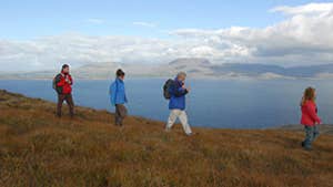
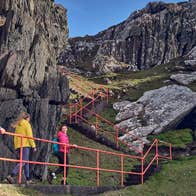
A-B. Leaving the trailhead at the Butter House follow the blue (and green and orange) arrows and travel a short 30m before turning left onto a laneway. The green arrows are for the shorter Cahergal Loop, the orange arrows for the more difficult Peakeen Walk – a linear trail which crosses the mountains to Kilcrohane. Ascending quickly, the loop joins a green track and after crossing three stiles, enters an open field towards the mountains. Crossing a stile at the end of the field, the loops separate – the Ballynatra Loop and Peakeen Walk proceed straight uphill, but you turn left following the blue arrows.
B-C. The loop now crosses a section of open hillside to reach a surfaced roadway in the townland of Cahergal. Here it crosses the road and joins the Sheeps Head Way (a long-distance trail marked with the familiar yellow arrows and walking man) for almost 3km along Gortavallig and the north coast of the peninsula. The loop and Way continue to overlap with each other to the end of a ‘green’ laneway in the townland of Reagh where the Way veers right – but you turn left onto a surfaced roadway.
C-D. After a short distance the loop turns right and crosses a stile into farmlands. Note that you are also following the red arrows of the Poet’s Loop - one of two loops that start and finish at the top of the peninsula. Ascend to reach another surfaced roadway, where you turn left again and shortly afterwards turn right across another stile and ascend to a ridge where you rejoin the Sheep’s Head Way. Here you turn left (and leave the Poet’s Way) and make your way along an old green road for approx 1km. At the end of this section the loop and Way turn right and descend to join the ‘main’ road where you turn left. After 200m the shorter Ballynatra Loop joins you from a roadway on your right. Continue straight ahead – it’s only 100m back to the trailhead!
Trail details
- Type:
- Walking Trail
- Location:
- Sheep's Head The Black Gate
- Grade:
- Very Difficult
- Format:
- Loop
- Length:
- 8.60km
- Ascent:
- 315m
- Dogs allowed:
- No
The last village on the peninsula, the supermarket in Kilcrohane is your last chance for provisions.
