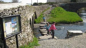
A large sign on the approach to Drimoleague describes the village as being the heart of West Cork. Here at the heart is to be found rich folklore, warm friendliness, down-to-earth faith, lively cultural expressions and a varied and interesting history going back to St Finbarr of the 6th century and beyond. It is a landscape comprising mountains, undulating farmland, pristine riverbank, woodland and a largely unspoiled flora and fauna. Drimoleague lies in the River Ilen basin, and its main street stretches out alongside one of its fast flowing tributaries, the Ruagach. Its location formed the natural junction for the Bantry and Skibbereen branches of the West Cork Railway, whose arrival here in 1880 transformed a scattered hamlet into a thriving village.
The village has much to offer the visitor - all around are reminders of its heritage: Beamish’s corn mills; three distinctive churches; and an old railway station which is preserved almost intact since the sad demise of the rail system in 1961. Beyond the village (and on this loop) is Barr na Carraige (the Top of the Rock) the old village of Drimoleague, rich in history and verse. The archaeological map of the parish is dotted with standing stones, ring-forts, fulachtaí fias, and holy wells.
A-B. Starting from the mapboard in the car park at the Old Railway building, follow the purple arrows along the old platform to reach a set of steps. (The yellow arrows and walking man logo are for the long-distance Sheeps Head Way.) Climb the steps and exit at All Saints Church where you turn left. Follow the road as it veers right and travel for 200m to reach a Y-junction where you turn left.
B-C. Still following the purple (and yellow) arrows, the loop now ascends steeply to reach the Top of the Rock at a crossroads where you turn left and, almost immediately, turn right into a viewing area. Enter a railed walkway and descend to cross a roadway, enter farmland again and descend to reach wooden railings near Ahnafunsion Bridge.
C-D. Joining the tarred road, turn right and cross the bridge and turn left. Almost immediately follow the purple arrow as the loop crosses the river Ilen and joins the opposite riverbank. Enjoy the riverbank trail for approx 500m and then turn left to ascend steeply, cross a road, ascend again and exit onto a roadway where you turn right.
D-E. Follow the road downhill for 200m to reach a farm laneway on your left. Follow the purple arrows as the laneway ascends and gives you fine views of the surrounding countryside. The laneway ends at a junction with a tarred road - veer left here.
E-A. This last section takes you along the road to enter Drimoleague at the west of the town. Turn left at the T-junction onto the main R586 and after 200m turn left onto a pathway which takes you back to the trailhead.
Trail details
- Type:
- Walking Trail
- Location:
- Drimoleague
- Grade:
- Moderate
- Format:
- Loop
- Length:
- 5.10km
- Ascent:
- 135m
- Dogs allowed:
- Yes
